Off the Boat
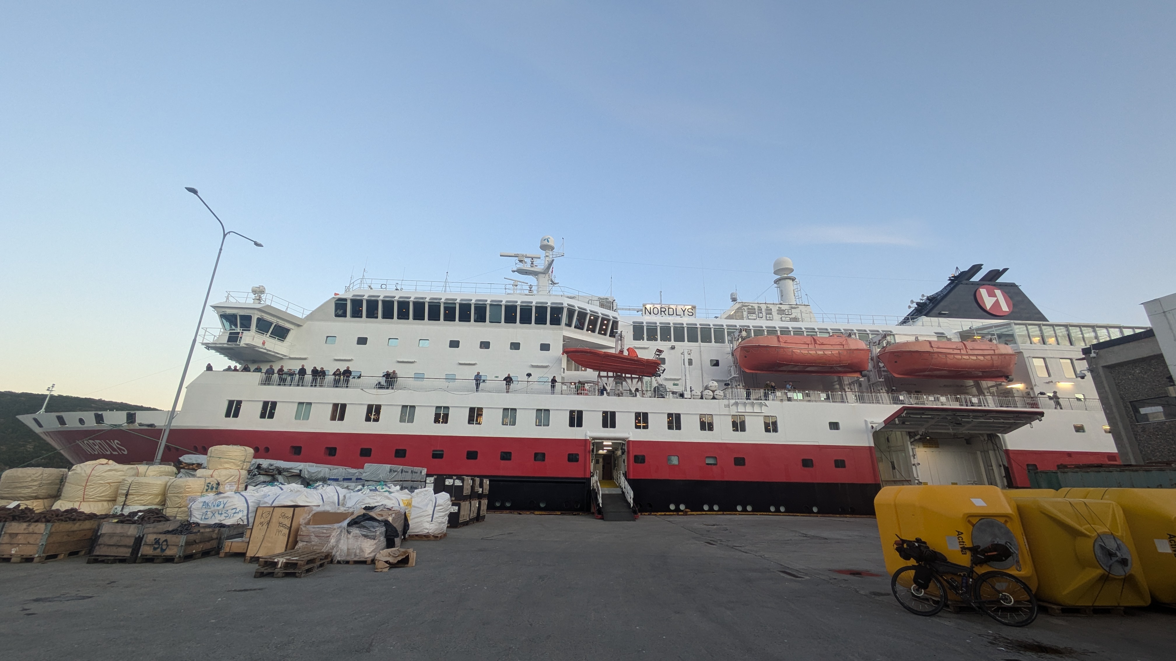
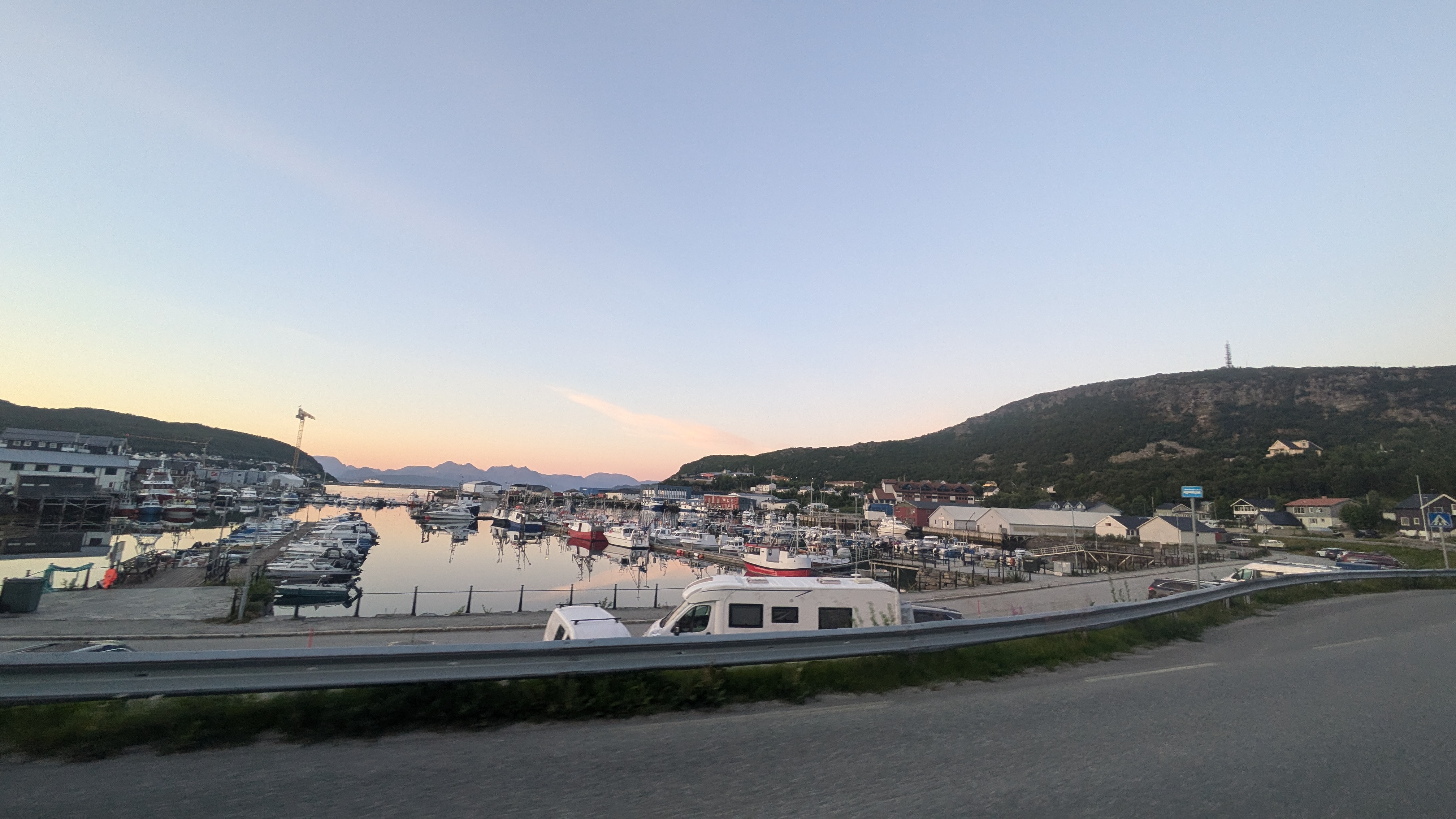
Turns out the crew of the MS Nordlys were not only happy to take me to the next port they called at, Skjervøy, without booking a cabin, but they also did it free of charge. That was very generous. When I was dropped off at Skjervøy just after 10 p.m. the sun already cast a shadow from behind tall mountains with glaciers on top. Apart from a supermarket everything was closed so I decided to not lose any time and start riding immediately. From Skjervoya a bridge leads to another, larger island, which is connected to the mainland through an undersea tunnel. That tunnel was a relaxed experience compared to the undersea tunnels I had biked through so far. During the 2.5 km I spend below the waters I was completely alone, not a single car passed through in both directions.
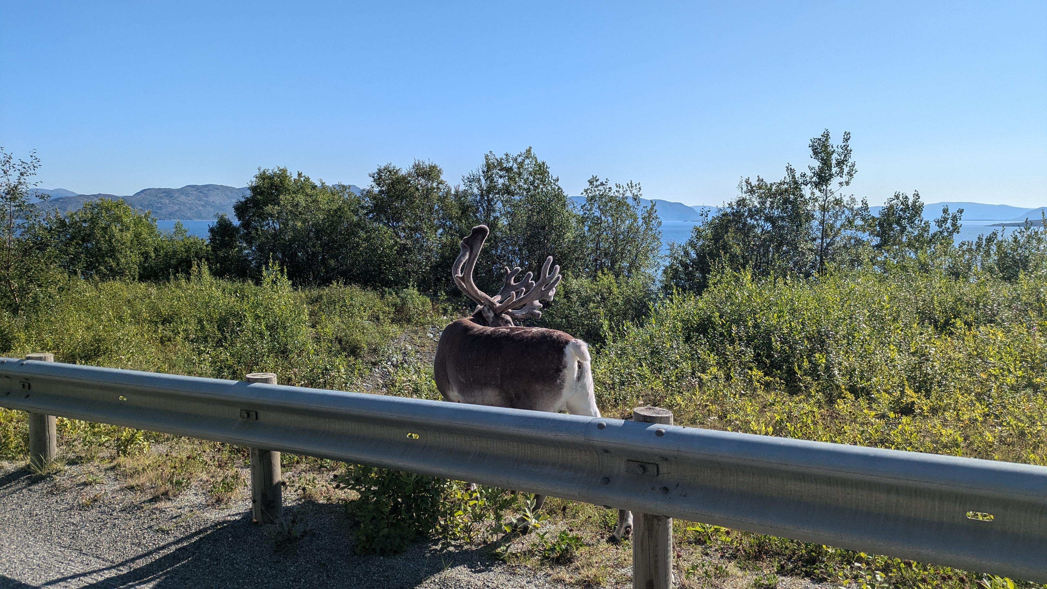
It wasn't just the one tunnel, there was close to no traffic at all at "night". No annoying campervans, just a few anglers here and there and some trucks, that was it. The wildlife agreed with me that the night was the perfect time to roam. A minute after my return to the mainland I had the second encounter with elks of this trip: two large specimens were lingering in the roadside trees invisibly when I passed until they were startled by the noise of an angler's car that was driving in the opposite direction and bolted into the forest further up the hill. Their size was enormous but they darted uphill at an impressive speed nevertheless. The reindeer too came out in great numbers, I met them at pretty much all points of the route today. They're not as shy as elks though so at least I could get some pictures of them.
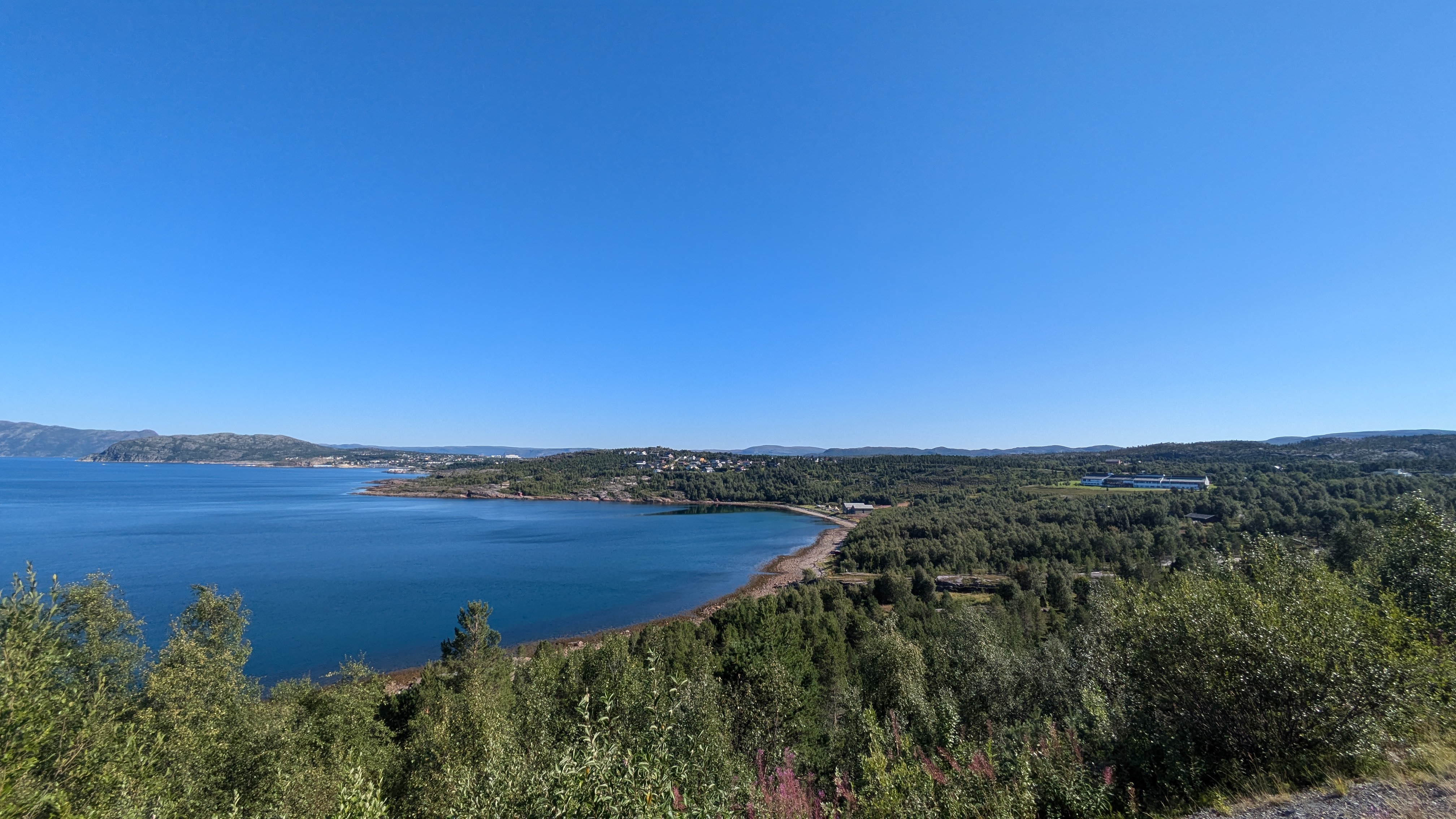
After 140 kilometers I had breakfast at the Langfjordbotn camp site. Originally the plan was to stay there for the night but since it was only 7 a.m. I decided to roll on to Alta instead after I had hot chocolate and coffee in the camp site's kitchen. The fjord view is still superb from there though so I regretted I couldn't stay longer.
Altafjorden
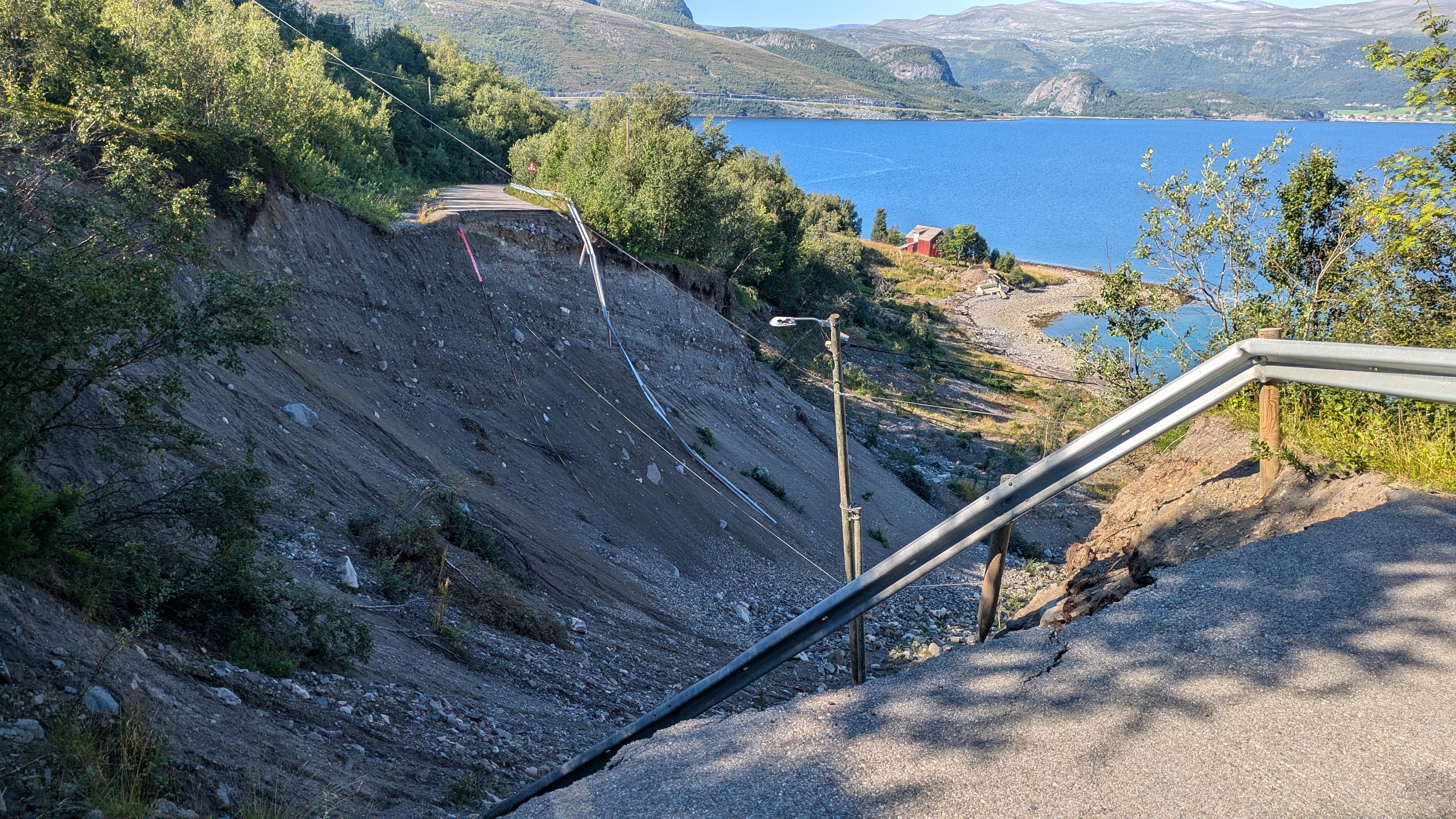
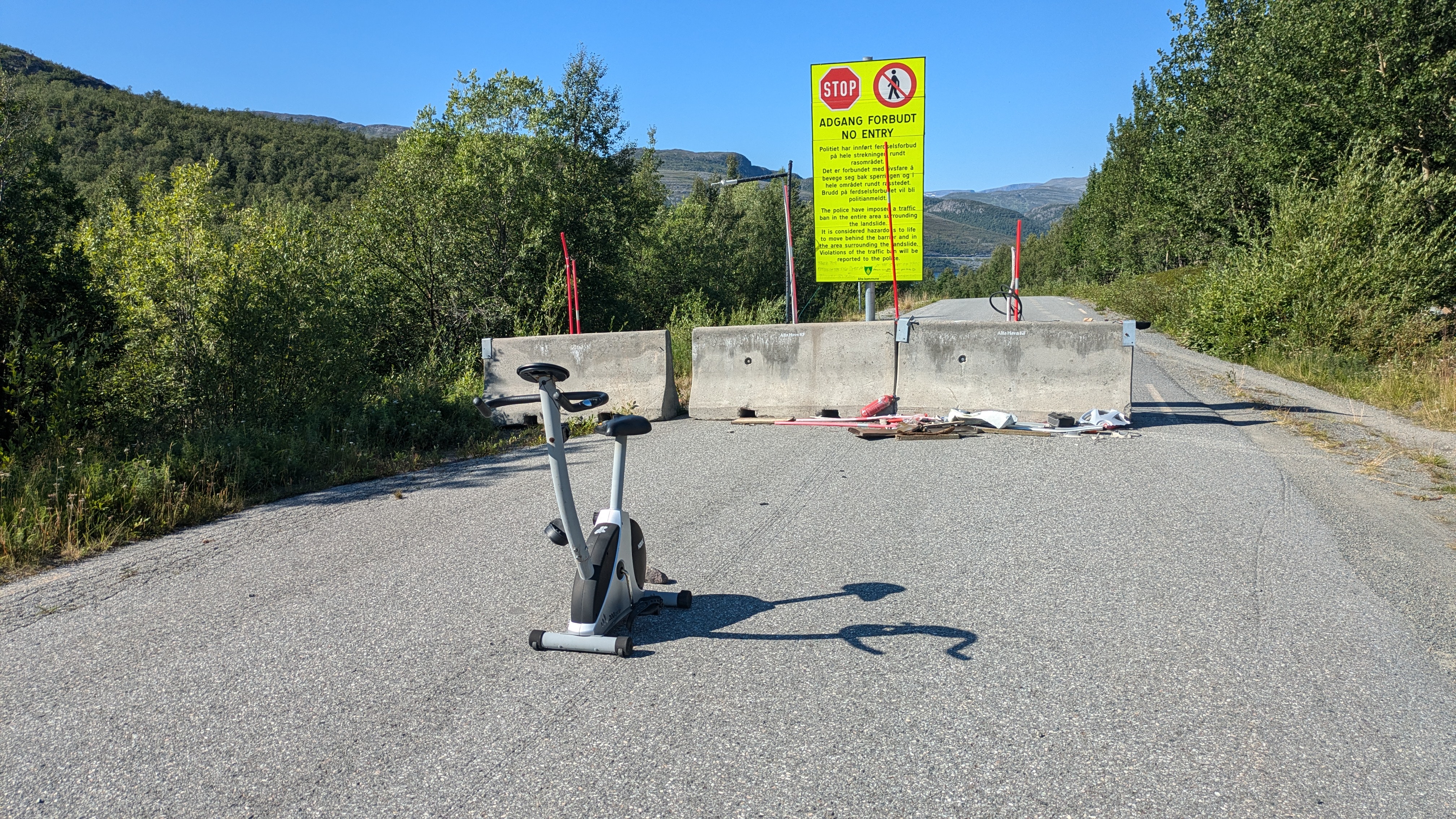
There's a series of tunnels on the eastern bank of Altafjorden, most of which are permitted for cyclists to use. They all have alternative routes for use by cyclists that while detours are often preferable due to the scenery and the undisturbed riding on decent roads without traffic. One of those alternatives crumbled away three years ago due to a landslide that took with it about twenty meters of road surface into the sea. When I tried to go that way two years ago there was no way around the missing bit of road but, as I was told by two tourers who I met during my breakfast at Langfjordbotn camp site, there now is a hiking path just above the landslide, suitable for pushing the bike around it. Approaching the site from the north the path is a bit steep initially so I had to carry the bike rather than push it. On the other end I spotted a bicycle but no cyclist was anywhere in sight. I stopped for a short break and after a while a woman in cycling clothes showed up on the other side of the landslide – one of her pannier bags fell down the ravine while she was pushing her bike up the path and she had to hike all the way down to the bottom of the landslide to retrieve. That's a bit of bad luck for sure!
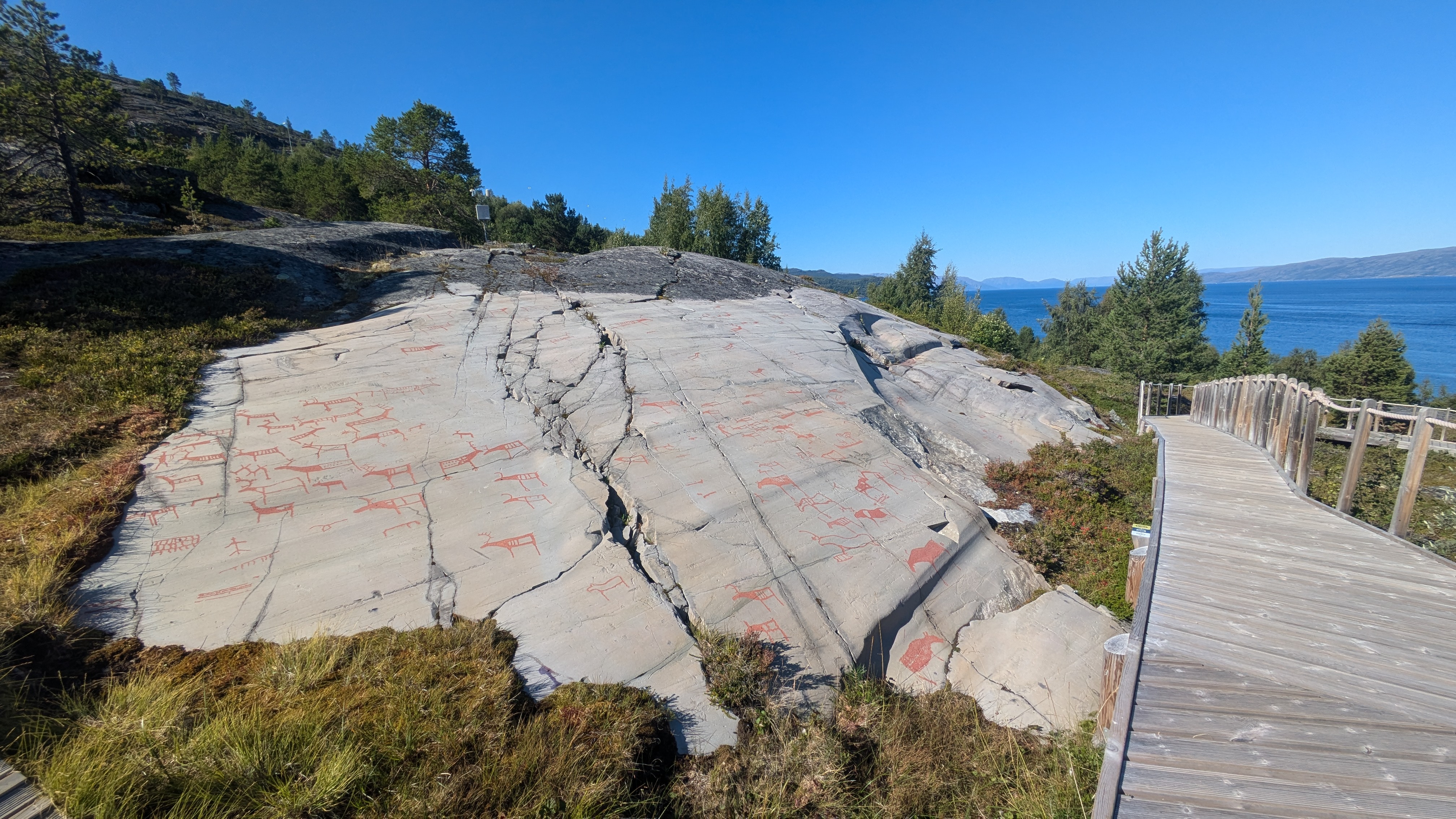
When I reached Alta I still had some time to visit the museum of rock carvings as I did two years ago. Since I want to do things differently this time around I spontaneously did the walking route in reverse, going back in history as I ascended the slopes by the sea.
It was still early in the afternoon so I could easily make the express boat that would take me up the fjord to a different road than the one I took on my last trip. Luckily Norway isn't as backwards as Germany so I plenty of opportunity for shopping groceries in Alta before I boarded the boat.
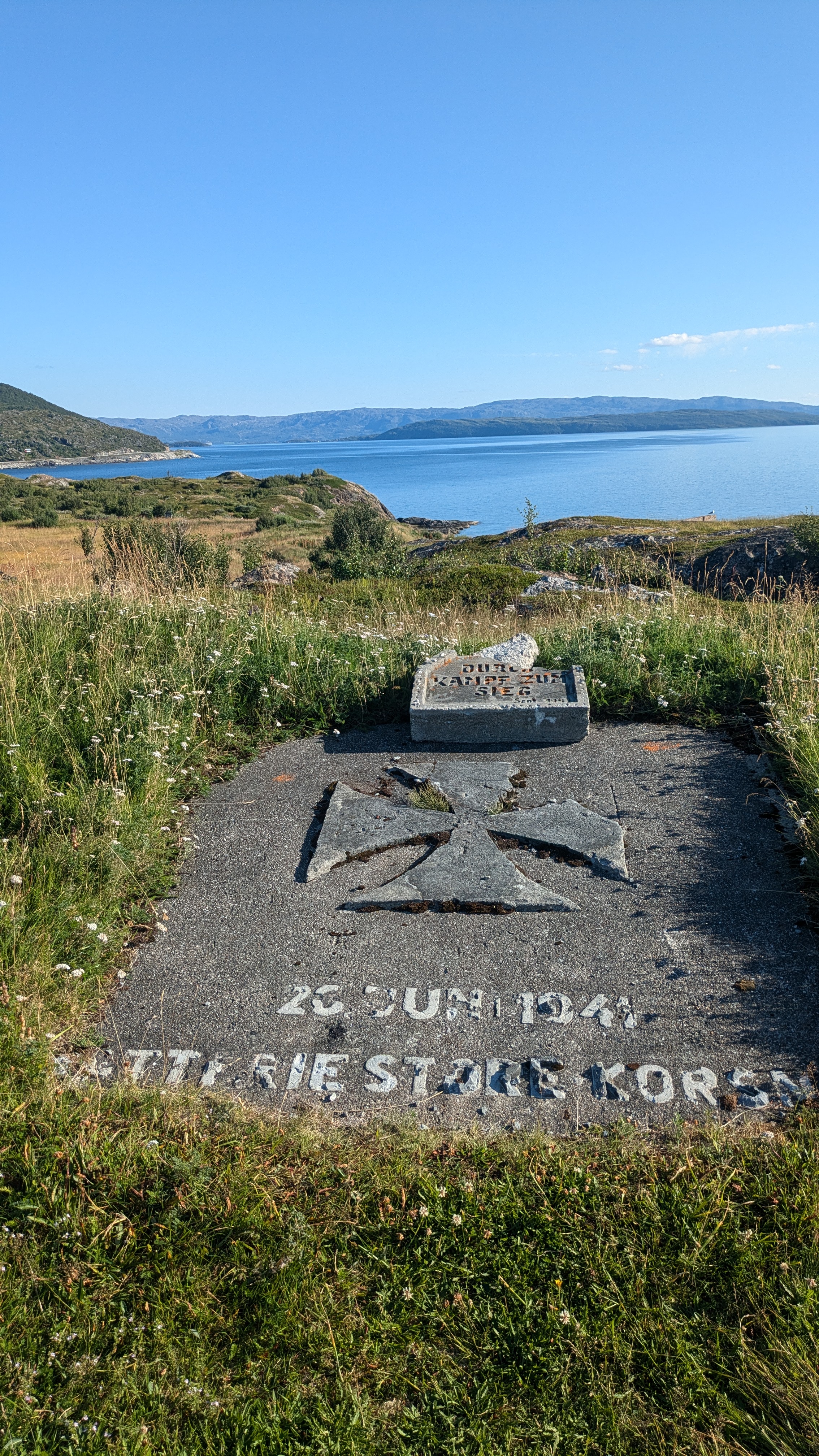
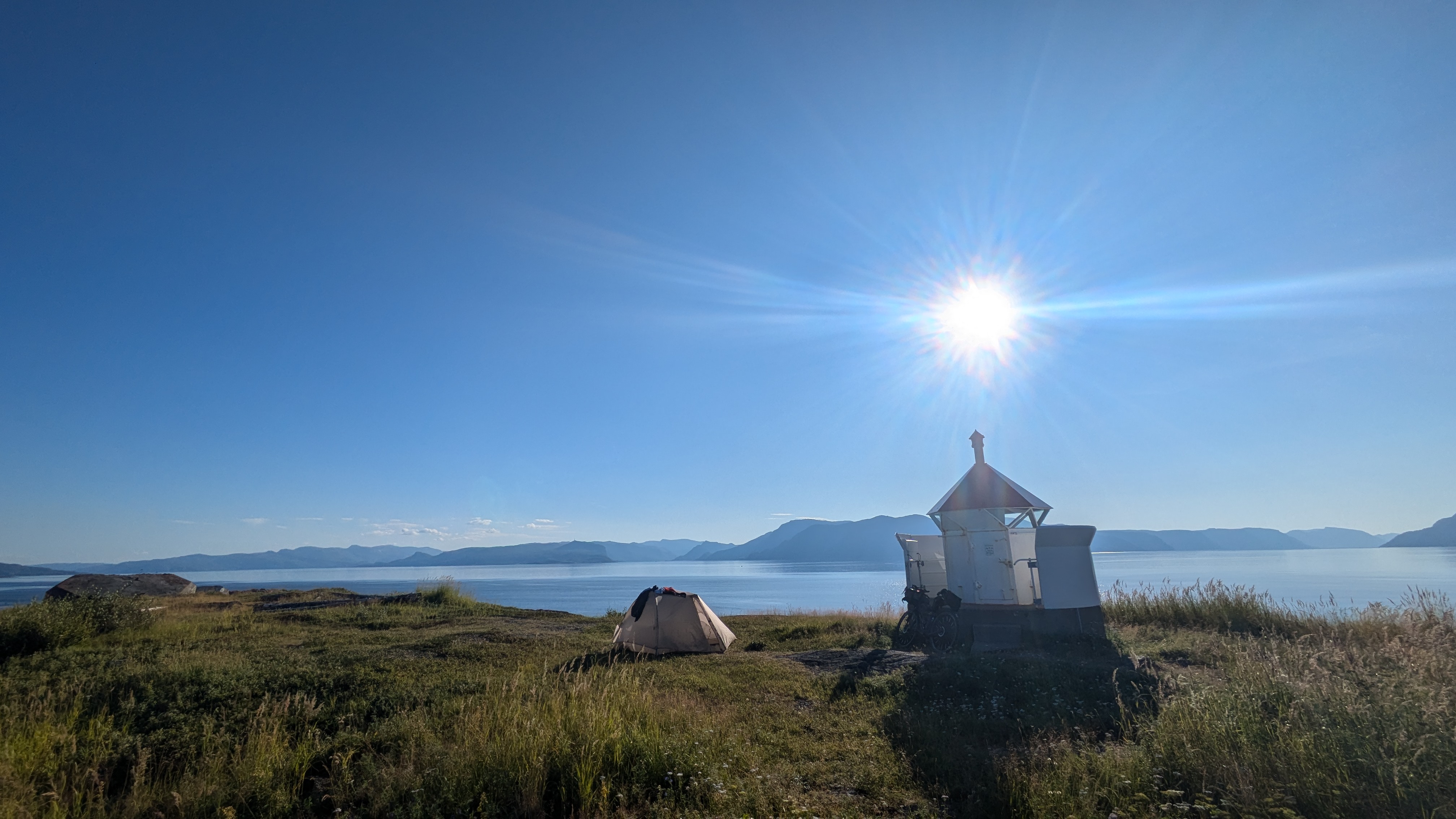
At Storekorsnes I got off the boat again but this time it was to be the end of a day of cycling, not the beginning. Unfortunately the camp site in town that I was aiming for does no longer exist. It's on me to fix the entry on OpenStreetMap I suppose. The map showed an interesting "fortress" on the promontory that extends from Storekorsnes into the Altafjord so I just had to check that out. Which turned out an excellent idea as the site – ruins of one of the batteries the nazis erected on the Norwegian coastline during World War II – has a panoramic view of the fjord and plenty of grass to pitch a tent on. After walking around the ruins for a while I settled on a spot next to the small lighthouse where I could observe the seagulls, other birds, speedboats and jetskis on the sea. A perfect site for wild camping that I had stumbled on by accident.
gps tracks
gallery