Varangerfjorden
Right out the Skiippagurra campsite I climbed for a while until the scenic descent down to the Varangerfjord, one of the larger fjords which extends to the Barents sea. The locals seem to be mostly Saami, at least judging by the vernacular I heard spoken in the gas station and the supermarket in Varangerbotn which clearly wasn't Norwegian.
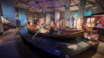
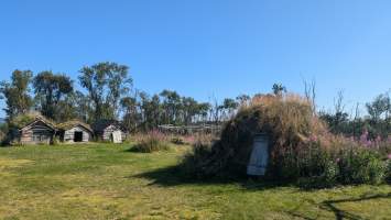
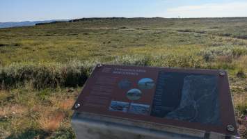
In town I visited the Saami culture museum which sits right at the innermost point of the fjord. Archeology was the most interesting topic there as it is faced with the challenge of discovering dwellings of semi-nomadic settlers who used mainly wood and soil as construction material. Since those rot away quickly, what traces to look for in the ground? Turns out due to their floor plan, Saami huts can be spotted by the characteristic circular remains of a fireplace that marked their center. Furthermore, archeologists have to account for the change in altitude of the shoreline since the region was first settled by Saami tribes. Settlements that were built down at the coast can now be found around 53 meters above sea level. Just a few kilometers into the fjord near Mortensnes there is an outdoor museum where the change of shoreline over the centuries and the wandering settlements can be observed.
Going East
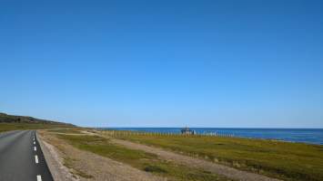
After days in the hills of Finnmark, the coast of Varangerfjorden is flat for a change. There was still some headwind every now and then but for the most part the air was calm. Excellent riding conditions!
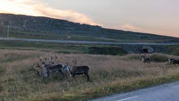
Vadsø didn't look much so I skipped it except for shopping. In the kilometers that followed the scenery changed significantly: gone were the rocks looming over the sea, they gave way to smaller, smoother hills with little vegetation on top. Bog plants left and right of the road, but this time at sea level. Reindeer with their brown color are perfectly camouflaged for this environment; grazing in the shrubs they are easily mistaken for stones.
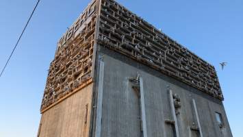
The closer I got to the tip of the peninsula, the stronger the headwind got. I still had plenty of time before my Hurtigrute boat would dock in Vardø so I made a detour to the town of Kiberg which advertises a bird site as their main attraction. That site turned out to be an old industry building at the harbor whose walls are covered in seagull nests. It looks like the building was adorned with a kind of scaffolding to encourage the birds to build their homes there. The plan worked out as was obvious from the hundreds of seagulls that inhabit the place now. Kiberg is right in advertising those birds, their crying, flapping, taunting, and zipping about was a spectacle in its own right.
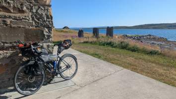
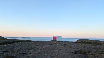
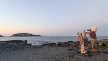
Near the summit of the final climb I spent some time at a viewpoint where a wooden wind shelter has been built with pink glasses. The panorama of the sea and the Vardø island is fantastic from up there, especially at the late hour with the sun about to set.
Vardø
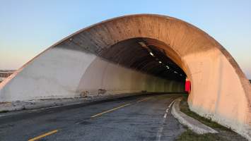
The town of Vardø is located on an island off the coast in the Barents sea. Geographically it is the eastermost easternmost town of Norway, situated at a longitude of 31.1 degrees east – more to the east than Saint Petersburg and all of Finland. To get there, one passes through Norway's oldest undersea tunnel. A traffic sign near the entrance to the tunnel warns of sheep. Which is not farcical at all, as there actually were sheep hanging out in the first twenty meters of the tunnel tube. Undersea sheep, what an amazing species.
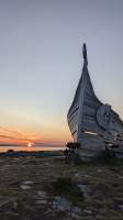
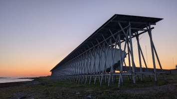
With the sunset getting closer I rushed out to the uninhabited area on the western half of the island to reach the Drakkar sculpture made of wood from old boats – a boat dragon instead of a dragonboat, if you will. It made for some superb photos with the red sun hanging low in the background.
There was much more to see in Vardø still. Next on my list was the Witch Hunt Memorial. Turns out that the locals were exceedingly superstitious back in the days which cost the lives of dozens of people, often just because of bad weather. And in normal years there's a lot of bad weather in the region.
Finally I visited the Vardohus fortress which served as a defensive installation and as a prison at various times. Officially opening hours were already over but they left the gates open so I snuck in there regardless. In its present form the fortress is rather small but Vardø has seen some serious military action in the past, including during the second world war when German soldiers razed it after they failed to hold the town against the allies.
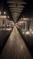
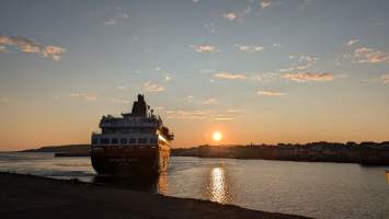
It was still two hours before the MS Richard With would arrive so I rolled through the streets randomly looking for a place to nap. Ultimately I settled on the parking lot with a prime view of Hornøya, the easternmost point of Norway Supposedly the island is one of the main breeding grounds of puffins on the Norwegian coast. I did not spot any of those elusive birds but I had one great cycle of sleep nevertheless shielded from the wind. At 3:10 a. m., just a few minutes after sunrise, I could spot the ship approaching the port of Vardø. As remote as Vardø is, I still wasn't the only person at the dock waiting for the boat to Kirkenes at this ungodly hour: There were three more, all of them cyclists.
