Skye
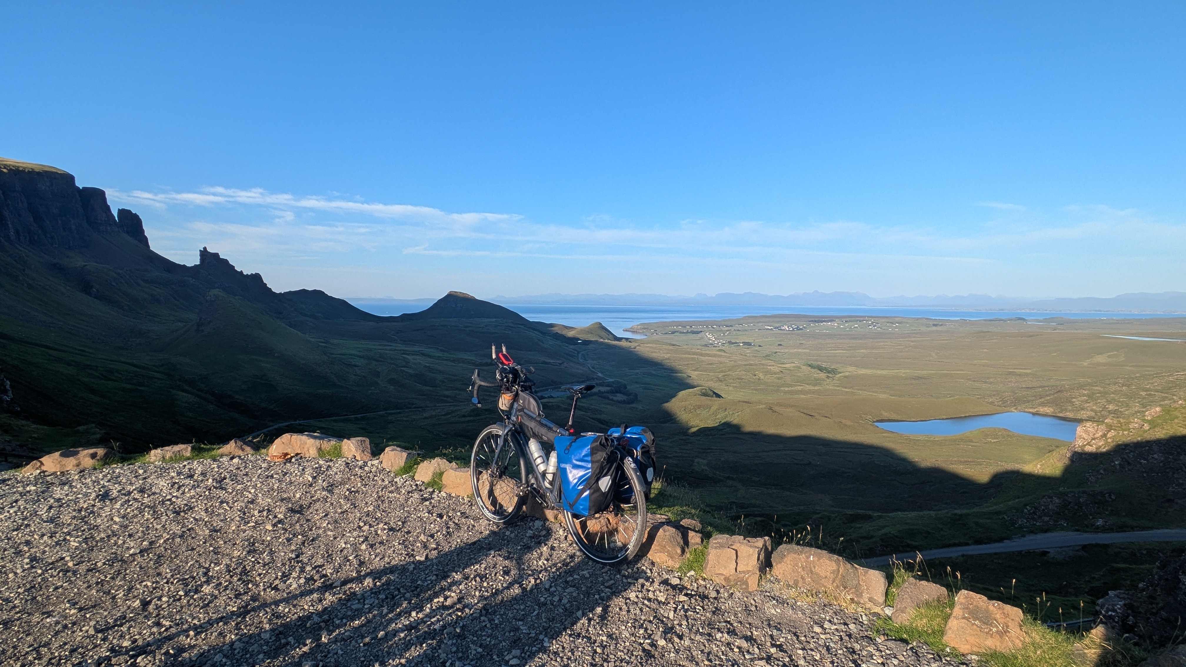
It was late afternoon when we disembarked from the ferry in Uist and all the shops were already closed. The weather was rather nice and warm however, and our legs were still fresh so we decided to use the rest of a gorgeous day and climb the Quiraing. The road to the pass wasn't very busy at that time of the day, but its surface way worse than any road we'd seen on the Outer Hebrides. It was riddled with potholes as deep as a kitchen sink. Also the drivers were a huge downgrade from the outer islands; it's not just that they didn't greet, they also largely ignored the passing places on the single track road, often acting confused as to why the road suddenly wasn't wide enough for traffic in both directions. Thankfully only a few lost cars tackled the Quiraing at 21:00 h so our ascent went largely undisturbed.
The ascent from the west proved the easier, albeit longer, route up to the pass. There's a large parking lot up there to accommodate the masses of tourists during daylight hours; it was almost empty when we arrived. The view down the rocks on the east side towards the sea is breathtaking. Since it was all quiet we got out the stove and cooked dinner there while we enjoyed the panorama, but had to flee when the wind subsided and thousands of midges came down on us hard.
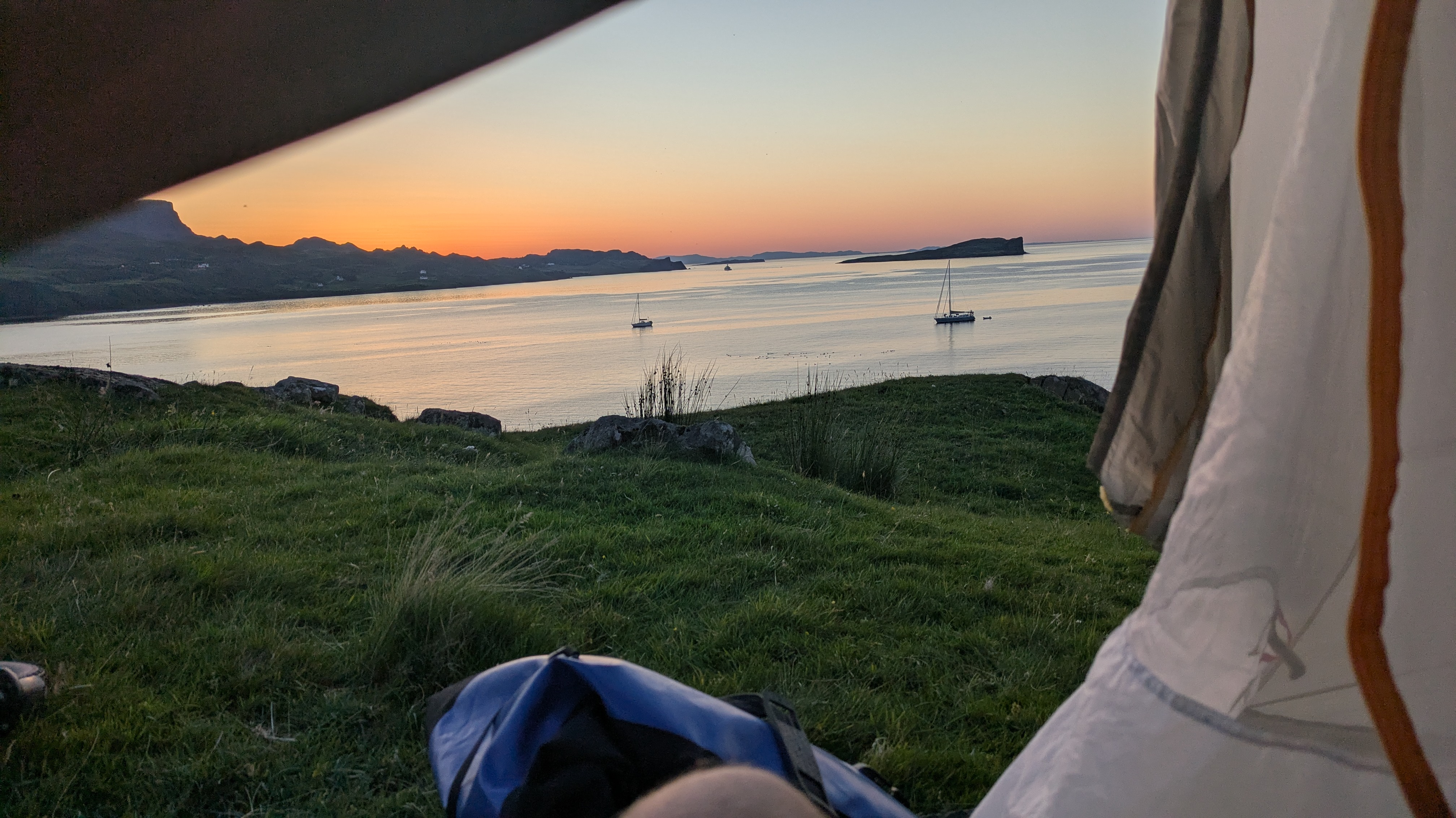
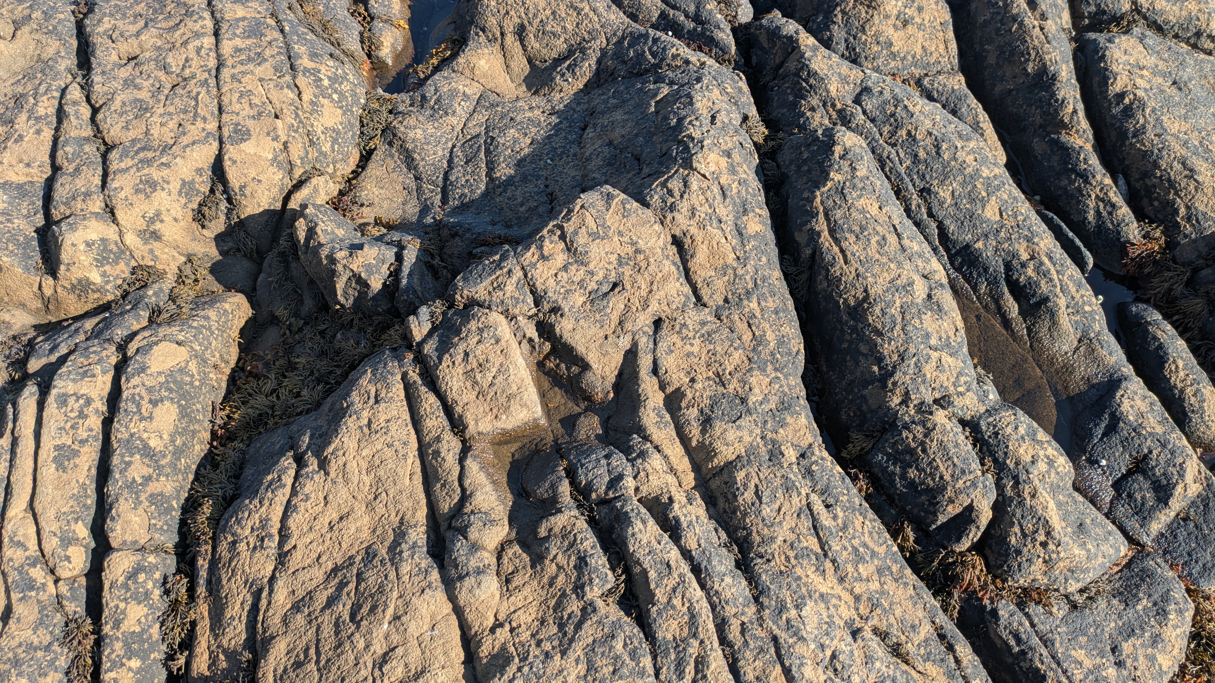
The Staffin campsite was overrun and requires pre-booking, which of course we didn't as we weren't even certain we'd reach it. Instead we found an amazing pitch down near the beach on a slope overlooking the bay. It was the best location to check out the dinosaur footprints on the rocks at low tide in the morning, and a stream nearby served as our morning bathroom.
We stopped at the tiny village museum in the morning which has more beatifully preserved fossils on display that were found in the vicinity of Staffin over the decades. The museum director kindly gave us a lecture about the museum and its exhibits; turns out a local craftsman started it as a hobby, and his collection eventually gained academic recognition.
On the coastal road to Portree we passed a few landmarks like the Old Man of Storr, a vaguely humanoid shaped rock on a crag high up over the sea. The parking lot at the bottom of the hike up to the rock was filled to the brim with campervans, but the public toilets came at the right time.
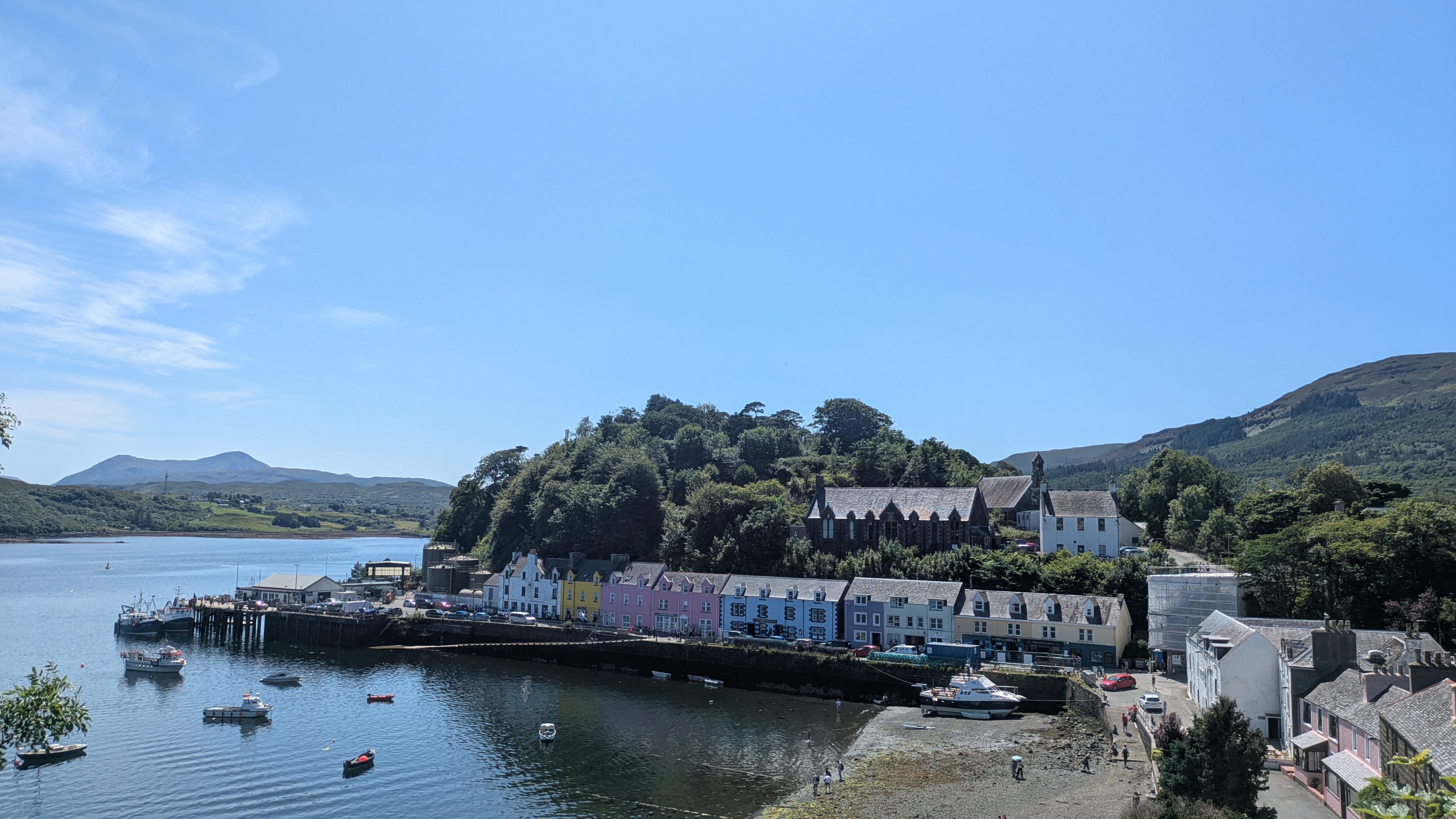
In Portree we bought a new gas cartridge -- apparently we used quite a bit of energy brewing tea against the cold weather -- and most importantly a mosquito net that one can wear on the head. At this point we had no idea how important that net would become later that day. We dropped by the port to take some pictures -- it does look pretty! -- before we got back on the road again, heading further south to the mountains.
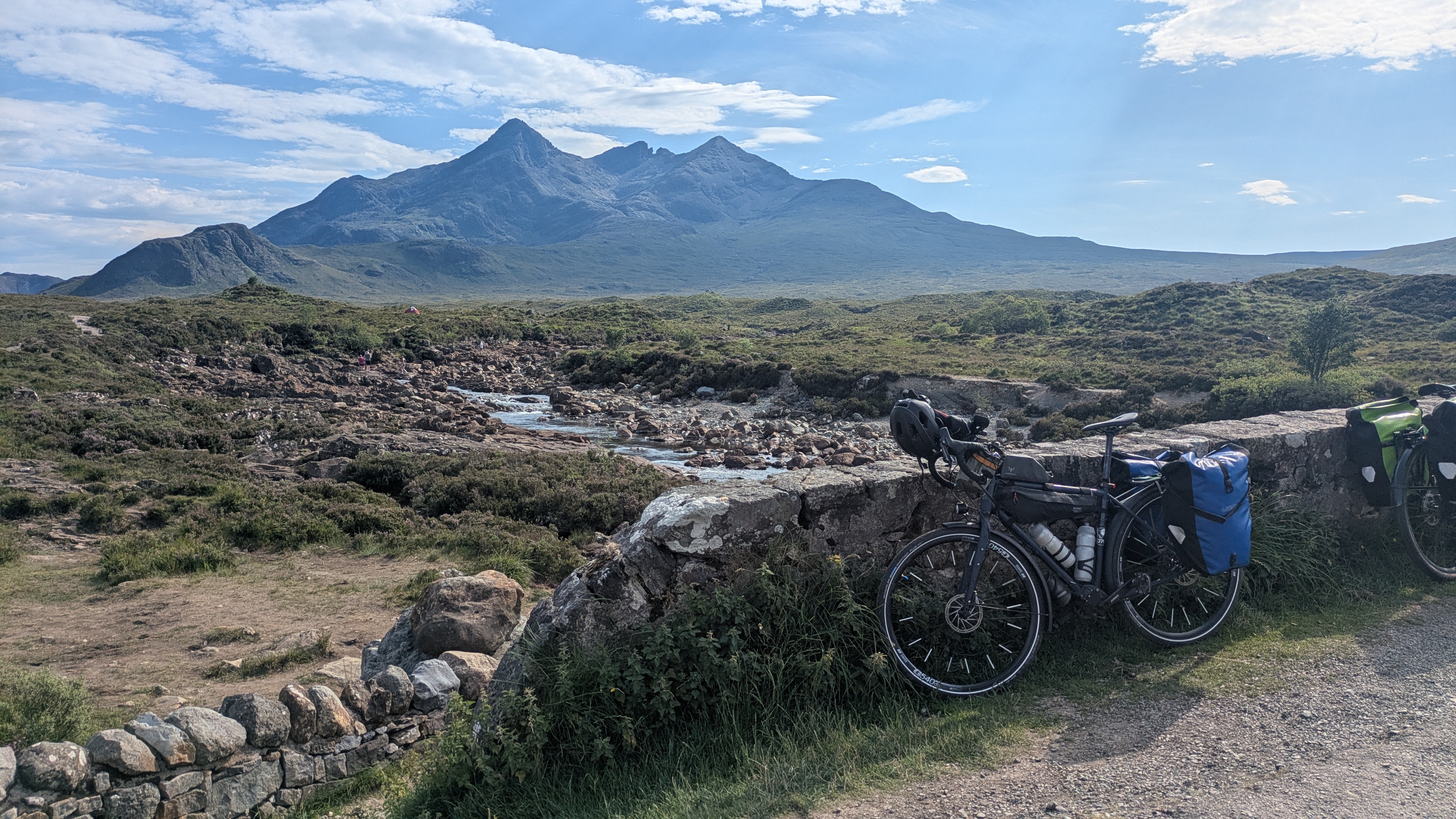
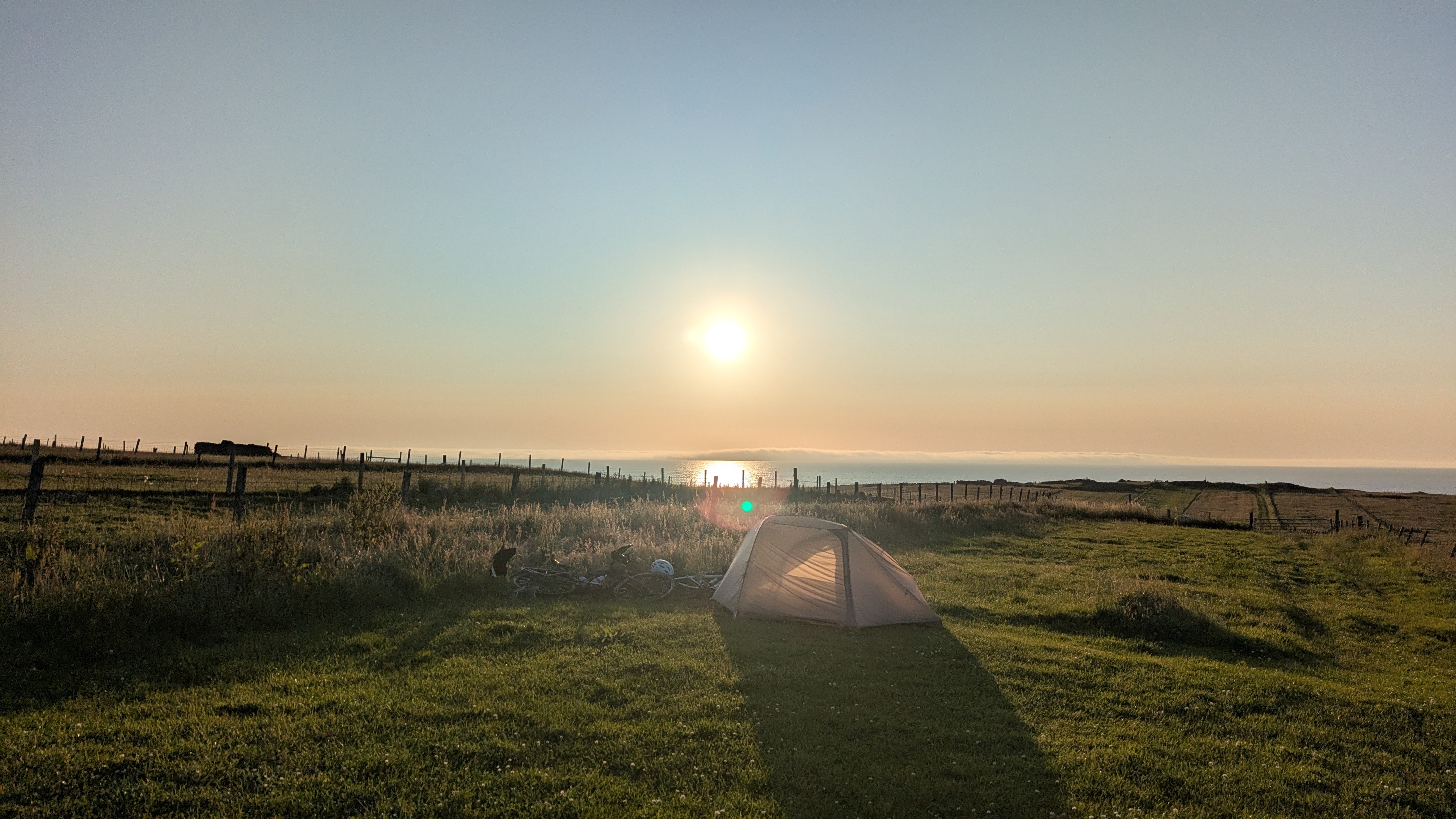
At the Cuillin viewpoint in Sligachan we took some more pictures before turning around to take the road north on the west coast. Compared to the busy east this part of the island was almost devoid of traffic. Once more we opted to use the great cycling conditions to ride further into the evening and reached Dunvegan around 21:00 h. After the fantastic experience the night before we again pitched close to the sea with a view of the bay, however this time around the beautiful site was a trap: next to it lay a bog from where countless midges and even nastier bugs homed in on us to eat us alive. The tent was pitched in record time, and with our new fancy mosquito net we took shifts outside it to perform various tasks. Without wind or rain to keep them at bay, the bugs were everywhere, and they were out to kill. As careful as we were, we could not prevent midges from getting into the tent every time we opened one of the doors, and every time we spent the next five minutes killing any that made it inside. Riddled with midge bites we broke camp early in the morning, disillusioned and insufficiently rested.
At that time Dunvegan castle was still closed so we didn't even get to see the castle or its garden. The early start in the day had one upside though: we were certain we'd catch the ferry to Harris in the early afternoon.
Harris
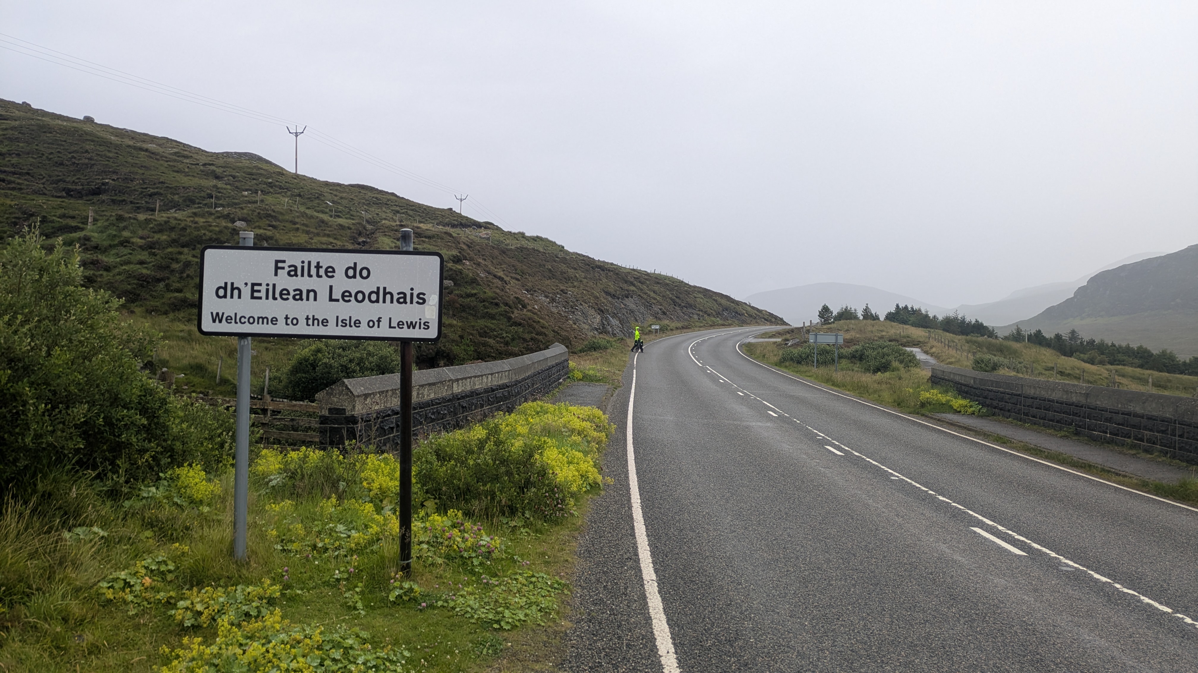
It had started to rain a little while we were still on Skye, but after we landed in Tarbert the precipitation it was pouring. Disappointed by the "campervans only" cheap excuse of a campsite there we went on our way to find a pitch for the night. The Met Office predicted the rain would subside but it didn't and by the time we reached Lewis we were exhausted and bordering hypothermia. Just in the nick of time we noticed a shed at the roadside that looked inviting. It was open.
Lewis
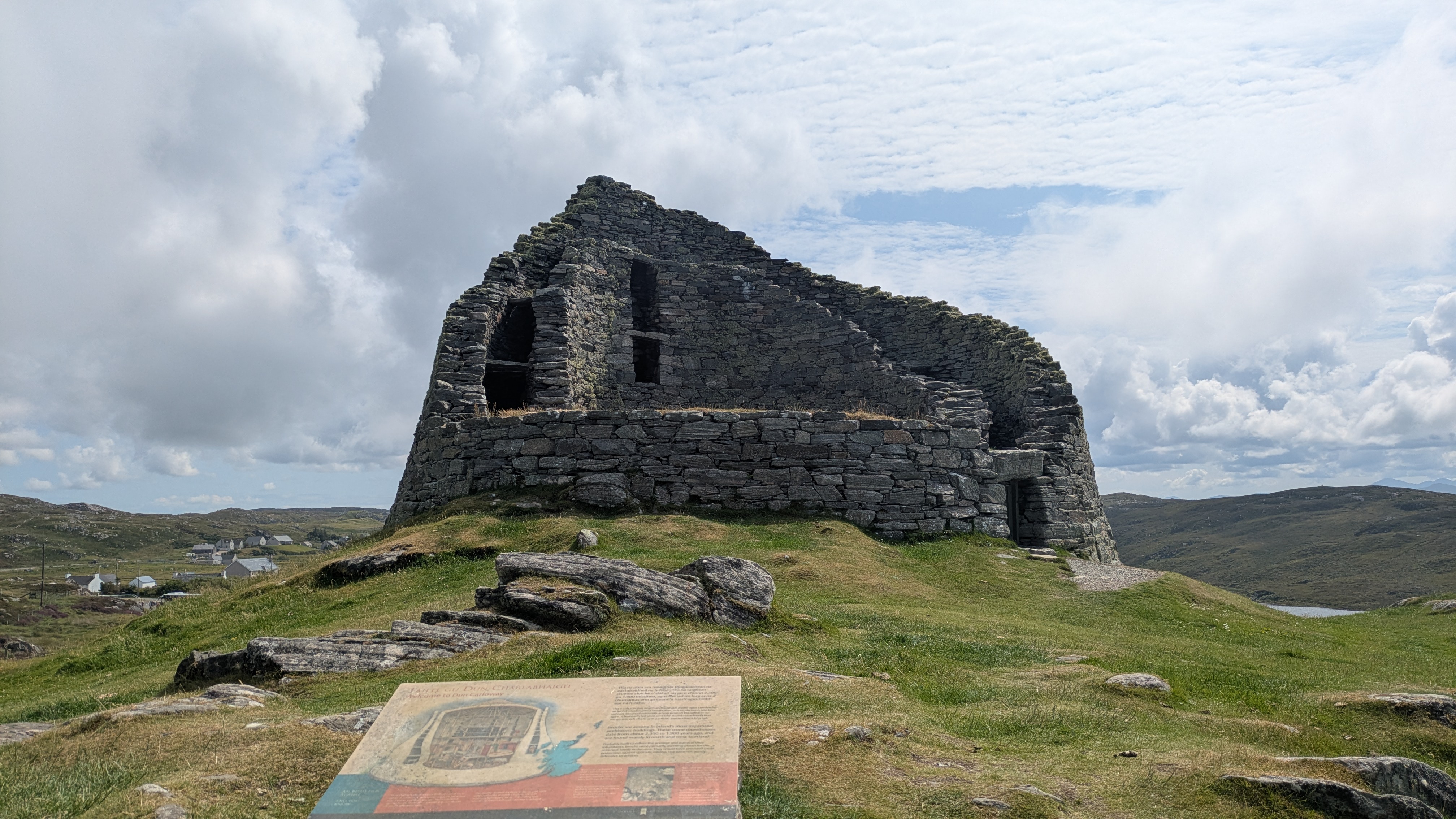
Turns out we had entered the territory of the Aline Woodland, a community owned reforestation project. The large stretch of dense conifer forest looks quite different from the rocks and peat bogs that make up most of the island's scenery. Long boardwalk circuits serve as hiking paths through the trees as the ground isn't normal soil but still largely a bog. Where those boardwalks branch off from the main road we found a shelter to spend the night in which, a great relief after a these past kilometers in the rain and wind; just a few meters into one of the hiking past there's another shelter which even has a rainwater-operated toilet -- to us, the Aline Woodland was one large forest of luxuries!
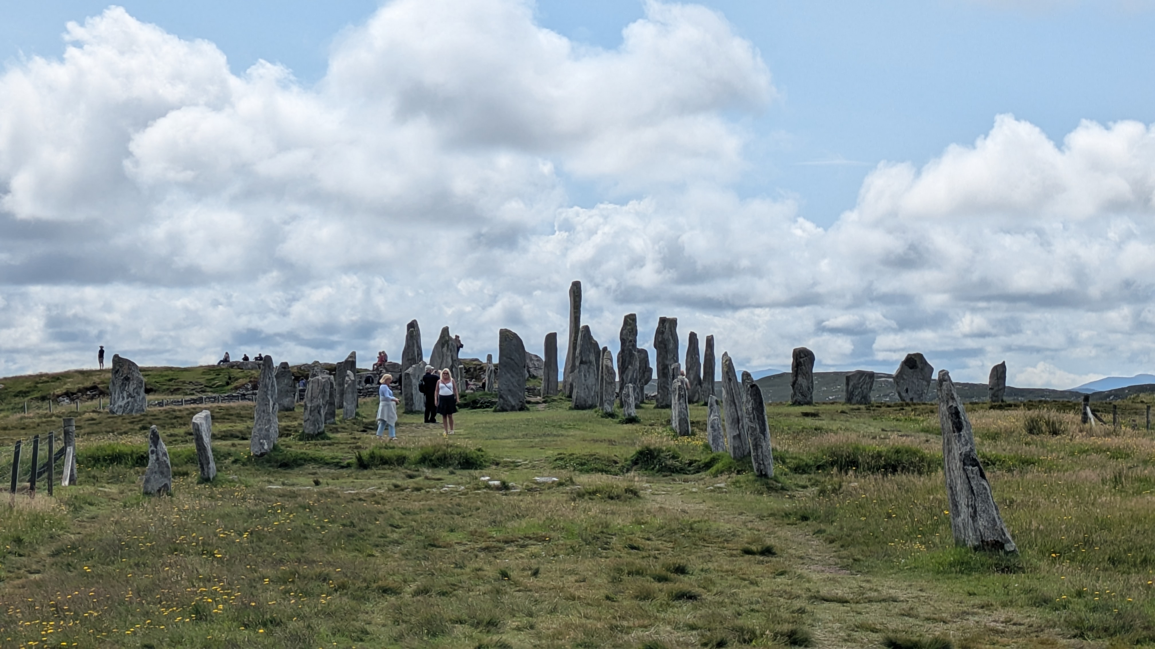
The next day, finally, we reached what is arguably the main attraction of all the islands: the Callanish Stones, a group of large stone circles in superb state of preservation, up there with the Ring of Brodgar on Orkney which was among the highlights of my last trip to Scotland. After visiting Callanish sites II and III we spent most of our time at the main site, Callanish II, which exhibits a clearly visible aligment with the solstices and equinoxes. The visitor center is closed for the time being, apparently it is undergoing a large scale overhaul. As good a reason as any for us to return in a few years!
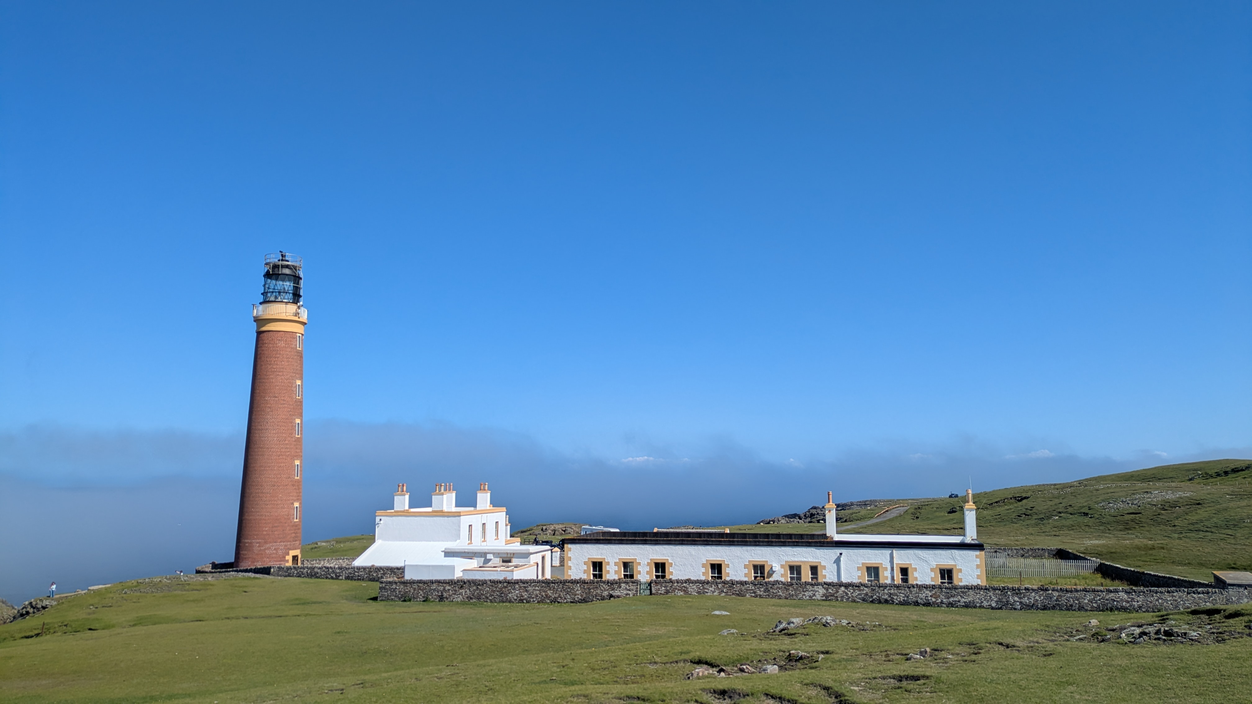
As this marks both the halfway point of our journey and the northernmost point on our itinerary we took an off-ish day near the Butt of Lewis and cycled a few kilometers to the lighthouse and back. This also means we completed the Hebridean Way, south to north, and rightfully claimed our certificate on that website. What's more, after cycling past dozes of "slow down for the otters" signs for more than a week without seeing a single representative of the species we finally caught a glimps of one otter swimming about between the cliffs at the lighthouse. Talk about closure for real!
We were about to change direction and scenery radically as this was also the final day out on the islands; that is, not counting Great Britain itself. In Stornoway some artists from the HebCelt music festival gave a street performance which we caught before embarking on the ferry ride to Ullapool, leaving the Hebrides behind.
gps tracks
gallery